


NSW Floods in Infrared
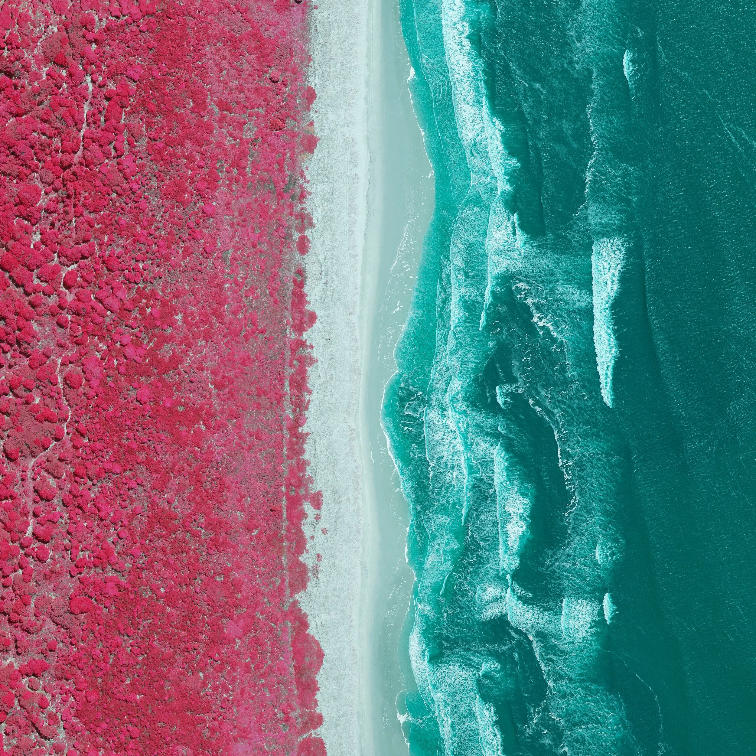
Scenes captured via NSW Spatial Services near-infrared post catastrophe imagery. The unique colour scheme provides emergency professionals the ability to better differentiate flooded areas from vegetation, compared to regular aerial imagery.
Trees glow pink and red as they reflect light in the infrared band of the electromagnetic specturm, which contrasts greatley agains the water which absorbs the wavelength, appearing in cyan.
This makes it easier to visualise the extent of floodwaters, which would appear as green or brown against the vegetation in regular RGB aerial imagery. This effect infrared has been used for scientific purposes for decades, with film stocks such as Kodak Aerochrome.
Leica Large Format Aerial Near-Infrared
NSW Spatial Services (CC-BY)
03/2021